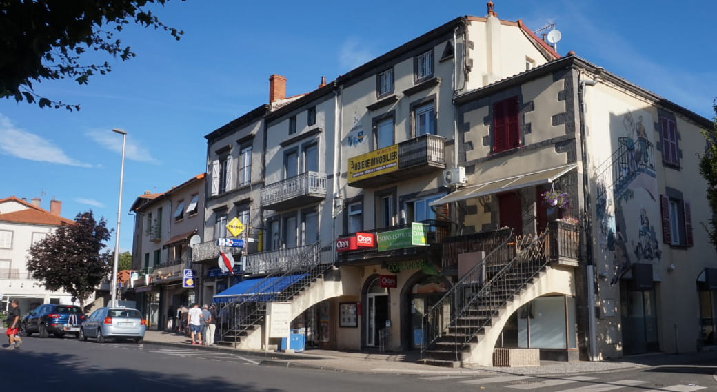
The Place des Ramacles owes its name to a story dating back to the Middle Ages until the 19th century, from the era of fiefdoms to the peak of vine growing.
Aubière used to be divided into two fiefdoms, one belonging to the counts of Auvergne and the other to the bishop. The village fort outer wall, identifiable on the land register, encompassed the château and the church. Its remains are still visible: at the end of Rue Voltaire (Porte des Ramacles), Place des Ramacles (ditches), Place du Roudet (wall), and a very strange alleyway known as “manhole” which joins Rue Voltaire via Impasse Beauvert.
The property of the lord of the manor, the Ramacles were a vast and humid plateau planted with willow trees, alders or poplars, between the outer wall and the Artière. Once a year, the Baron of Aubière authorised the residents to do “remailles”, meaning to cut all the branches of the willow or alder trees. “Remaille” led to remacle(s), then ramacles, hence Place des Ramacles.
The houses, built against the ruins on the north face of the Place des Ramacles, had no outlet on the square. In the early 19th century, for more direct access to their vat rooms and caves, winemakers opened their houses onto the south by building several staircase bridges. They were built without municipal authorisation, above the reach of the stream, used as a washing station, running along the walls. Through legal means, in 1819 the owners obtained the right to keep these bridges, “provided they maintained the washing stones for public service and permitted and facilitated at all times their use through convenient surroundings.” They were later named “ramaclés”. Only four of them remain today.
A commemorative fountain can be found: la fontaine de l’amitié (1969), in tribute to the Americans who came from the 55th artillery regiment to the town, in 1918 (sculptors: Fernand Auteroche and René Fontanel).
- Bus lines 3 and 12, Pl. des Ramacles stop
Periode d‘ouverture : Ouvert toute l‘année
All year round, daily.


