
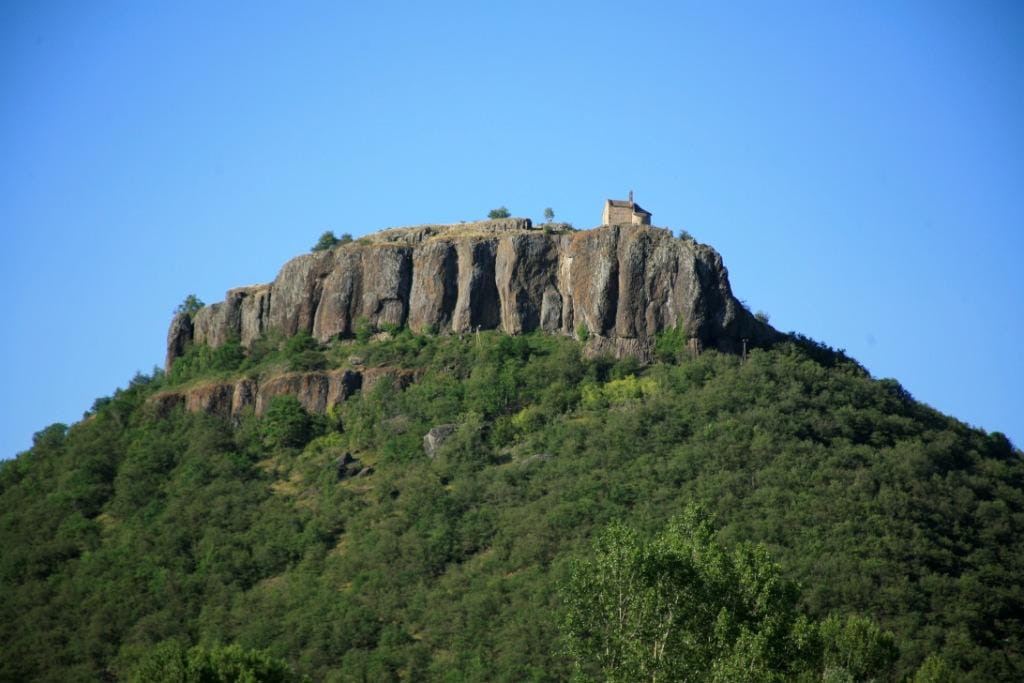
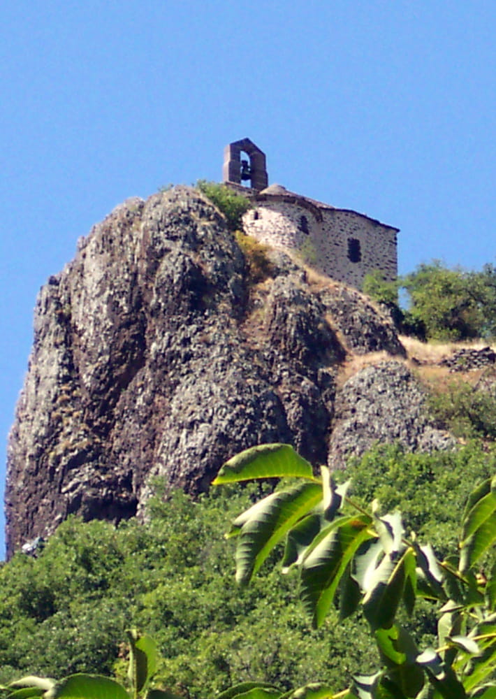
Ce parcours vous mène à la célèbre chapelle Sainte Madeleine, cette ancienne chapelle castrale perchée sur son éperon rocheux. Découvrez ruelles et maisons à « estre », et arpentez les coteaux.

Description détaillée Informations complémentaires
Departure point - Massiac: tourist office. Cross Place des Pupilles de la Nation, then Avenue du Général de Gaulle, and head up Rue Neuve, then Rue Jean Rieuf.
1- At the Massiac exit (D321), in a hairpin bend, go straight ahead on a dirt track. Pass under the motorway bridge, and the track climbs up through the woods, which conceal ancient terraces.
2- At the crow's-foot, turn left. The ruins of Chaumaresse are visible on the right. Follow the meandering path.
3- At the crossroads, go right up to the meadow. Go along it, then down on the track opposite.
4- At the Croix de Chevaley crossroads, take the leftmost track.
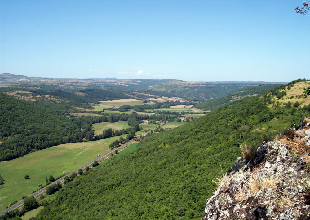
5- Cross the road (D321). Note a covered well on the left, at the crossroads at the entrance to the hamlet of Brousse. Continue straight ahead. On your left, you'll see a view of the Cézallier, with its remarkable summit: Signal du Luguet.
6- At the crossroads, turn left. Reach a road, turn right and cross the bridge over the freeway. Enter through the gate and climb the stairs. Retrace your steps and continue.
7- At the crossroads, turn left. Basalt organs, water trough and pump. In Chalet, note the winegrower's houses with "estres" and the ruins of Chalet castle, built by the Léotoing-Montgon family in the 14th century (first path on the right).
8- At the fork, go straight on. At the crossroads, 50 m to the right is an androgynous stele and 500 m to the left is the magnificent 12th-century Romanesque chapel of Sainte Madeleine, with a panoramic view over the Allagnon valley. Return to Chalet, and take the first path downhill on the right. This path, now undergrown, used to lead to vineyards.
9- At the hamlet of Vialle Chalet, take the second turning on the left, first a grassy path, then a tarmac road. Continue for 250 m, then turn left.
10- Go through the small tunnel under the freeway.
11- At the road, turn right. After the motorway bridge, take the first dirt track on your left, once a royal road used by Charles VII. It leads to a road and the cemetery. Turn left on the small road around the cemetery. Continue straight ahead down the lane. Pass an old garage (old petrol pump) and continue straight ahead between two houses. End in rue de L'Hôpital.
12- After about 100 m, turn left into rue de la Paix, cross avenue du Général de Gaulle and return to the starting point.
- Type : Boucle
- Nature du terrain : Ground, Hard coating (tar, cement, flooring), Not suitable for strollers
- Environnement : Close to a motorway, Forest location, Station district, Close to a public transportation, Village centre, Panoramic view
- Animaux acceptés : A tenir en laisse
- Praticable en VTT et en VTTAE.
1h. Difficilie
On vous
recommande aussi
recommande aussi


Mise à jour le 18/06/2024 Par Hautes Terres Tourisme