
We discover the remains of a great clunisian priory where four popes stayed. The walk continues in the narrow gorges of the Chaméane valley with views of the puys mountain range, Sancy, Cézallier, Allier valley and Forez.
Description détaillée Informations complémentaires
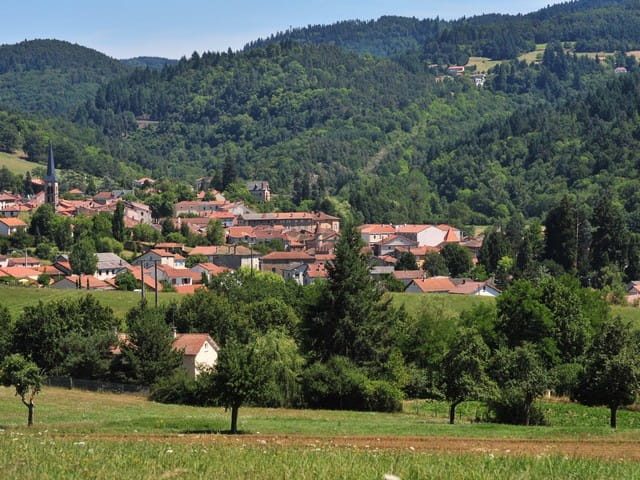
Starting point - From the starting sign at the bottom of the car park, go down the main street. Turn left, cross the Place de l'Ancienne Poste, follow the rue des Coufferts. Cross the bridge (bief or "béal"), take opposite the Petite rue des Coufferts then turn left on the D214 for 200 m and then left again on the D144, go up the road on the left (view on Sauxillanges, Val d'Allier, puy de Dôme, massif du Sancy) and continue until the D144.
1 - Take the D144 to the right. After the transformer, turn left on a steep slope through the woods. At the T-junction, turn left. At the crossroads, turn right towards Ventre. Enter the hamlet from the left. Go down the first path on the left until you reach the fork of the pond.
2 - Turn to the right and then immediately to the left. At the bottom of the valley, cross the stream wading. Go up to the right in the woods. After the clearing, walk along a softwood forest. At the road, turn left towards Chabreyras (view of the Puys chain). Cross the hamlet while staying to the left, then turn left into a wide dirt road. Ignore the side roads up to the D144.
3 - Turn left for 200 m. Turn right into a forest road. At the fork, go left. Follow the path on a steep slope towards the Chaméane river. Cross the wooden bridge and the D49 at Civadoux. Walk between the hostel buildings (old oat mill) and up into the woods. At the intersection, turn right. Go along pastures (view of the Dômes mountains and the Sancy massif). At the exit of the hamlet of Bonnefont, go down the road on the left until you reach the D706.
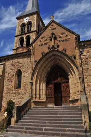
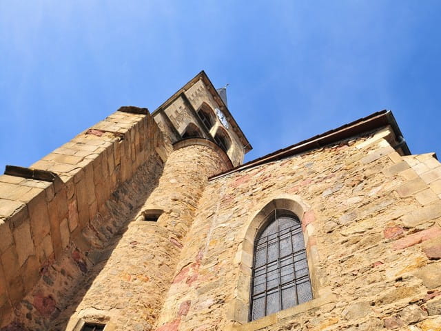
4 - Go to the right and at the hairpin bend take the road on the left that leads to Saint-Quentin-sur-Sauxillanges. Cross the road and then the square, pass the church (Romanesque church with bell tower) and go straight ahead in the path below which runs along a surrounding wall, ignore the adjacent paths. At La Coierie, turn right on the D49 for 20 m, turn left, cross the footbridge over the Chaméane stream and follow the path on the right. Go down the wooden staircase on the right, cross the bridge downstream of the confluence of the streams of Astrou and Chaméane, continue following the Eau-Mère. In Sauxillanges continue straight on the same road and at the end of the dead end go to the right rue des Tanneries, find rue des Coufferts on the right and get back to the starting point.
- Type : Boucle
- Environnement : In the country, Forest location, Presence of livestock and guard dogs
- Animaux acceptés : Les chiens doivent être obligatoirement tenus en laisse en raison de la présence de troupeaux.
- Pour votre sécurité, prenez toujours avec vous une bouteille d'eau, un chapeau, des vêtements chauds et contre la pluie, et équipez-vous de chaussures adaptées à la marche.
Selon les conditions météorologiques, certains itinéraires sont déconseillés par mauvais temps (brouillard) ou ne sont pas praticables, voire interdits, durant la saison hivernale.
Certains sites sont fragiles, restez sur les sentiers aménagés. Évitez de cueillir les fleurs sauvages et de dérangez la faune. Ramassez vos déchets.
Sur certains itinéraires, les animaux sont interdits.
Mise à jour le 12/06/2024 Par Conseil départemental du Puy-de-Dôme